(Services) (02)
Masterplanning
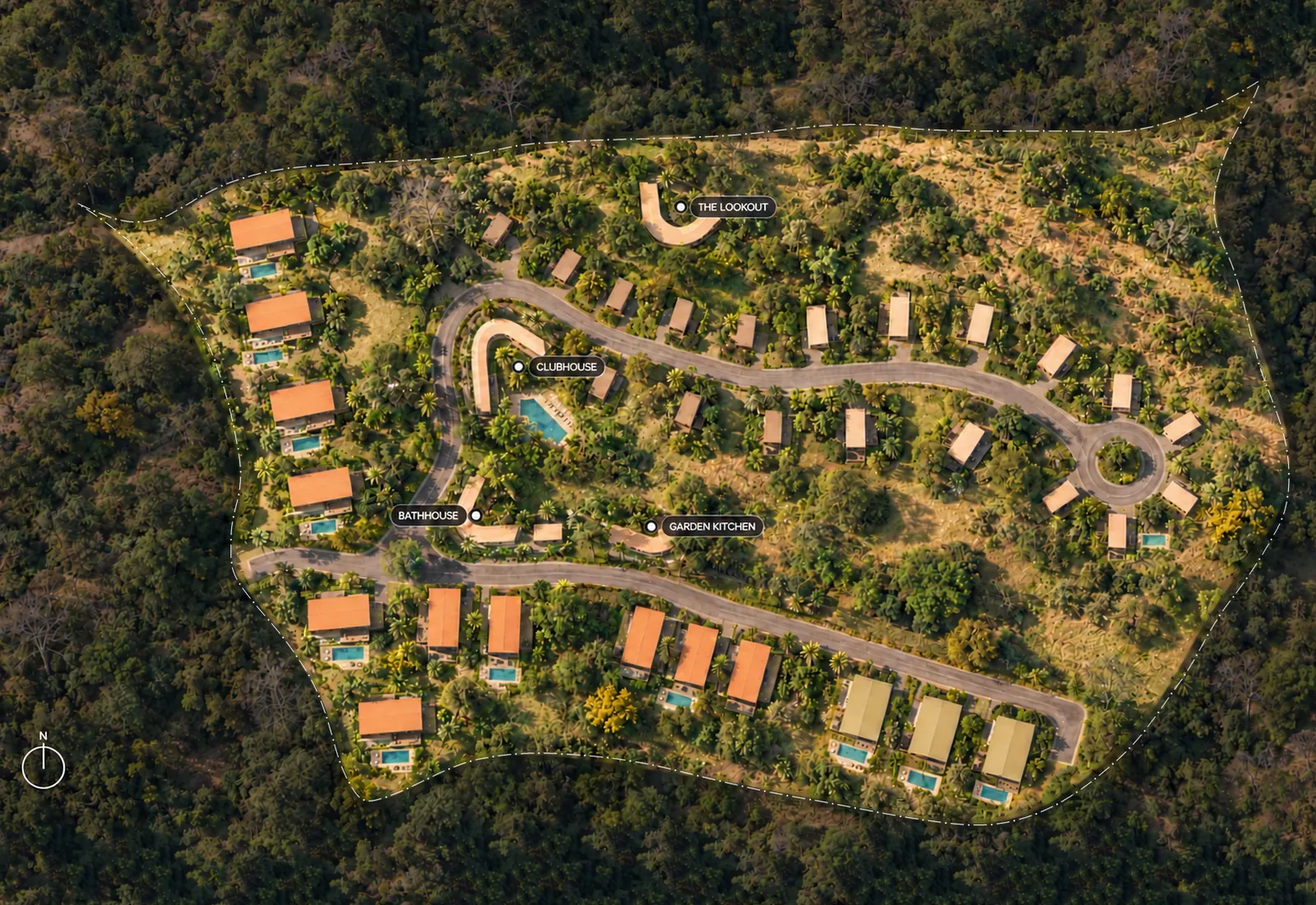
A master plan decides what a piece of land will be for the next twenty years: where the road runs, how the lots are cut, which house sits where and what everyone shares. We start the way we started La Perla, by reading the land, its height, its slope and where the rain runs, and let the plan come out of that.
(At a glance)
- Time
- 6 to 12 weeks once the topographic survey is in
- Fee
- A fixed fee agreed up front, set by the size of the land and the number of homes
- You receive
- The site analysis, the master plan with its lots and house types, the shared buildings, the phases and a cost range
(Who it is for)
- Owners of a large lot thinking about a condominium or a small development
- Retreats and hotels that will grow in phases
- Families sharing out land among several houses
- Investors who want to know how many homes the land really holds
(Reading the land)
-
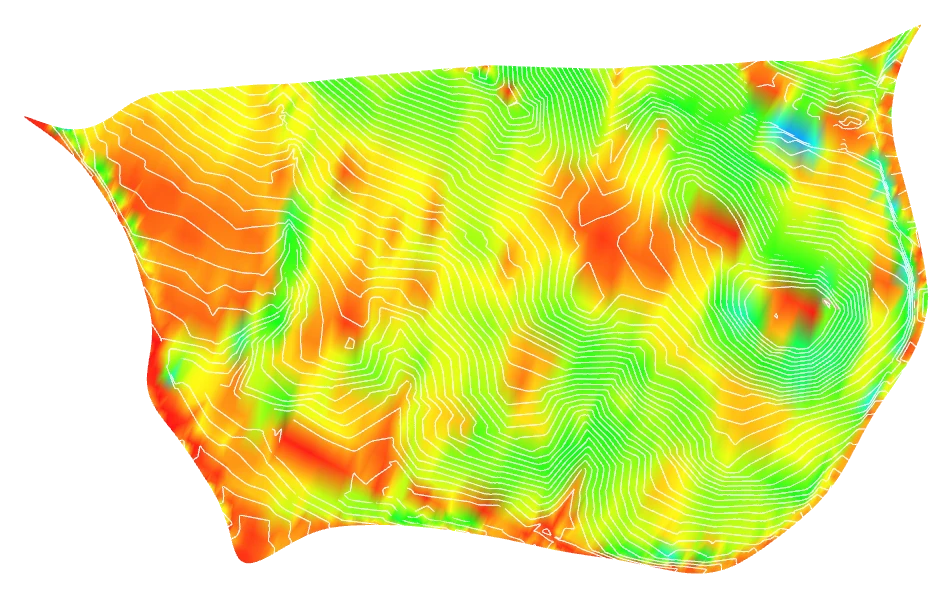
La Perla, slope (01) Land
Height and slope
Every point of the land coloured by how steep it is. The gentler ground is where a road or a house costs least to build; the steepest is left as it is, with its trees.
- Terrain model
- Slope map
- Ground to build on
- Ground to leave alone
-
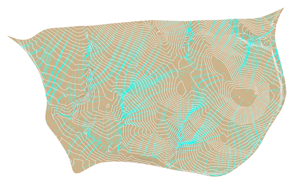
La Perla, runoff (02) Water
Where the rain runs
The paths the rain takes across the land, and the places where it gathers. Those stay clear of houses and become the drainage, the ponds and the green strips of the plan.
- Runoff paths
- Where water gathers
- Drainage kept natural
- Houses kept out of the way
-
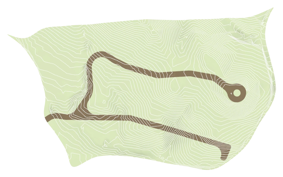
La Perla, streets (03) Access
One road
A single road that follows the contours to keep its grade gentle and its cut small. Fewer metres of road means less to build, less to maintain and more land left for the houses.
- A road that follows the land
- Gentle grades
- A turning circle
- Less paving
-
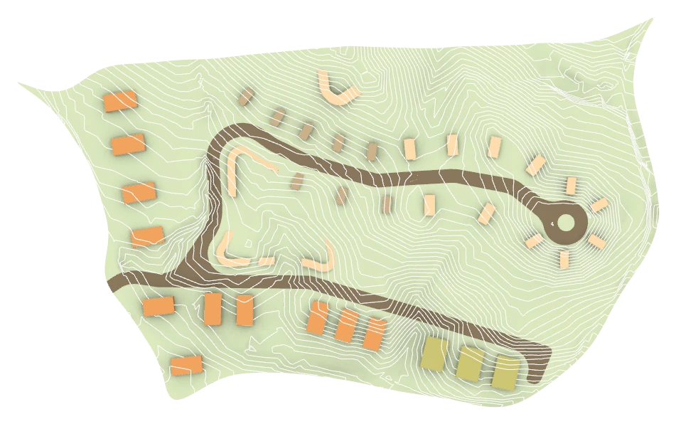
La Perla, lots and houses (04) Program
Lots and house types
The lots cut along the road, each with a house type that fits its ground, and the shared buildings placed where everyone can reach them. The numbers come with it: homes, areas and density.
- Lots along the road
- Four house types
- Shared buildings
- Homes, areas and density
(How it runs)
-
(01)
Read the land
Weeks 1 to 3We model the land from the topographic survey and read it layer by layer: its height, its slope, where the rain runs and where it gathers, the views, the trees worth keeping, and the strips the law protects along rivers and around springs 4.
You receive
- A terrain model with its slope
- The paths of the rain, and the ground to keep clear
- Protected strips and setbacks
- Sun, wind and views
-
(02)
The plan
Weeks 3 to 7One road that follows the land to keep its grade gentle, lots on the easier ground, house types sized for the people you want to sell or rent to, and the shared buildings where they serve the whole place. We draw two or three options and choose one with you.
You receive
- Two or three options, then one
- The road, the lots and the house types
- Shared buildings and open land
- Areas, homes and density
-
(03)
Ready for the next step
Weeks 7 to 12We draw the chosen plan to the level a permit and a buyer need: every lot on the site plan, each house type in plan and in volume, the order it can be built in, and what it would cost.
You receive
- The master plan, drawn
- House types in plan and volume
- Phases
- A cost range for each phase
- What the permits will ask for
(Fees)
A master plan is a fixed fee agreed before we start, set by the size of the land and the number of homes. The topographic survey, the soil study and any environmental study are paid to the specialists who carry them out.
If we go on to design the houses or the shared buildings, the master plan counts as the preliminary studies for them, so that part is not charged twice.
(Not included)
(Questions)
What is the difference between a master plan and designing the houses?
The master plan decides where everything goes and how big it is: the road, the lots, the house types, what is shared. The houses are designed afterwards, one at a time, inside that plan.
Do I need a master plan for a condominium?
How long does it take?
Six to twelve weeks once the topographic survey is ready. The survey usually takes a few weeks of its own, so it is worth ordering it first.
Can the plan be built in phases?
Yes, and we draw it that way. The road, the water and the power are laid out so the first phase works on its own and the next ones join it.
(Sources)
- Ley 7933, Ley Reguladora de la Propiedad en Condominio (current text, version of 16 March 2026). SINALEVI, Procuraduría General de la República, 2026.
- Decreto Ejecutivo 45214-MIVAH-MEIC-TUR, Reglamento a la Ley Reguladora de la Propiedad en Condominio (in force 19 January 2026). SINALEVI, 2025.
- Reglamento de Fraccionamiento y Urbanizaciones. INVU, via SINALEVI, 2019, current version 2026.
- Ley Forestal 7575, article 33, protected areas. SINALEVI, current.
- Decreto 43898-MINAE-S-MOPT-MAG-MEIC, Reglamento de evaluación, control y seguimiento ambiental. SINALEVI, in force 20 August 2023.